Italy Sardinia
“The Nuragic Civilization”
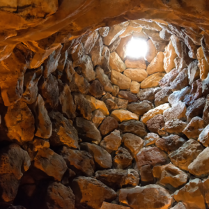
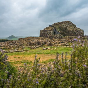
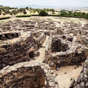
Sardinia is probably blessed with one of (if not the) most beautiful coastlines in all of Europe and is the second-largest island in the entire Mediterranean. It was settled thousands of years ago by people from the mainland of Europe, probably around 18,000 BCE. These people later developed into the island’s singular “nuragic” civilization. The Nuragic culture is virtually unknown to us as they left no written records. But the buildings that give them their name, the nuraghi, are littered about the island, with around 7,000 ruins in total, though there were probably more than 10,000 at their height. The nuraghi’s function is unknown, but they generally take the shape of a conical tower with layers of stone and masonry extending outwards.
Nuraghe building ceased around 730 BCE, when the Phoenicians (the modern Lebanese) began settling the coastline of the island. The Carthaginians (themselves descended from Phoenician settlers) took over around 510 BCE. After the First Punic War, the Romans invaded the island in 238 BCE, as the Carthaginians could no longer afford to pay for the armies occupying it. They joined Sardinia with the its neighbor to the north, Corsica, to form the second Roman province, Corsica et Sardinia.
The island would go on to be an important Roman granary, and Latin eventually overtook Punic as the island’s lingua franca. It was later taken by the Vandals, after their conquest of North Africa, followed by the Goths, then the Eastern Romans, who ruled over the island after the Western Roman Empire fell. Though nominally a part of that empire, their rule over the island faded throughout the Middle Ages.
The nuraghi form the majority of the ancient sites of the island, though I don’t have time to go over them all. I’ve tried to put in a smattering of the most well-known and accessible sites.
Northern Sardinia
Arzachena
8 different sites around the municipality of Arzachena, near the Costa Smeralda.
The center of the Arzachena people, a pre-Nuragic culture that occupied northeastern Sardinia. Characteristic of the culture were the circular graves and standing stones.
The park has 7 different sites. The links in their names take you to more information on them, with map directions next to them.
- Nuragic complexes of
- Tomb of Giants of
- Megalithic circles of the necropolis of Li Muri (map)
The times for each site can be found in the links above, as well as their locations. The rates for the archaeological park can be found here. Site packages and ticket deals vary, so look at all of them before making your decision! Riviera Nuragica details tickets and sites for the entire area as well! La Prisgiona has a ticket office next to it, so I’d recommend getting them there since I can’t see how to get them online.
Palmavera
North and west of Alghero.
Originally built somewhere between the 15th and 14th centuries BCE, it eventually became the main Phoenician trading post on the island. Later a Roman villa was built there, whose ruins are a part of the park.
Two towers and the huts of a village, along with the Roman villa and Sant’Imbenia, the Phoenician trading port.
The official website is in Italian but you can translate it to English by right clicking. It will give you all of the opening times and ticket prices.
Tharros
The central-western coast of Sardinia on the Sinis peninsula.
An ancient Punic-Roman settlement, Tharros was founded in the 8th century BCE by the Phoenicians. It was later conquered by the Romans in 238 BCE. It was eventually destroyed in the 11th century CE by Arab invaders.
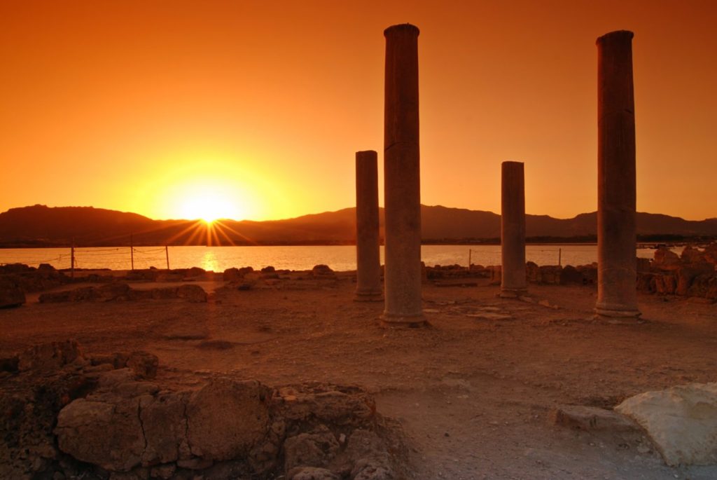
What is left of it is mostly just foundations, though the columns of the Temple of Demeter make a striking image next to Capo San Marco.
Olbia or Cagliari are the main entry points to the island. You may drive to the site from either city.
Cost/Hours?
This website has a nice collection of information.
Links
https://www.sardegna.com/en/tharros/
https://www.wanderingsardinia.com/articles/41/tharros
https://www.sardegnaturismo.it/en/explore/ancient-city-tharros
Southern Sardinia
Cagliari
On the southern end of Sardinia, Cagliari hosts two separate sites, the Tuvixeddu necropolis and the Roman amphitheater, which are near each other, along with the archaeological museum.
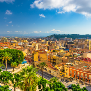
Sardinia’s largest city, as well as it’s capital, Cagliari is the main hub from which most tourists will explore the island. Inhabited since Neolithic times, Cagliari was established by the Phoenicians as Karaly in the 8th or 7th century BCE. The Carthaginians took over a large part of Sardinia, including Cagliari, in the 6th century BCE.
After Sardinia came under Roman rule in 238 BCE, it became known as Caralis. It was made the capital of the island by the Romans, later obtaining the status of municipium. It fell to the Vandals in the 5th century but was taken back by the Eastern Roman Empire only to gradually fall out of its control during the High Middle Ages.
- Tuvixeddu in Cagliari
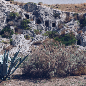
- One of the largest Punic necropoli in the Mediterranean, it is where the Carthaginians buried their dead. Dug deep in to the limestone rock, the most well preserved tombs include the Uraeus and Fighter tombs. A Roman necropolis exists on the outskirts.
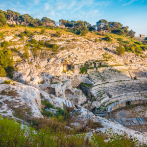
- Roman amphitheater of Cagliari, built in the 2nd century CE. It could seat up to 8,000 spectators.
Cagliari is the main hub of Sardinia. You can catch an easy flight from Rome or take a ferry from the mainland. Use the map locations above to find the various sites in the city.
Antas
In the southwestern part of the island in the territory of Fluminimaggiore.
Although it began as a Nuragic sanctuary, it later developed under Carthaginian rule, until it reached it’s peak under the Romans, both during the 1st and early 3rd centuries.
The temple itself is in fairly good condition.
Start-Uno has a lovely site, with a part of it dedicated to the Temple of Antas.
Nora
The southern coast of Sardinia, about 40 minutes southwest of Cagliari
Supposedly the first city founded on Sardinia, Nora was conquered by the Phoenicians, and later the Romans. Like other Roman sites of ancient Sardinia, its influence did not extend to the interior of the island, as the native Sardinians were allowed to go about their business until they slowly Romanized over time. It was conquered by the Vandals after they had taken North Africa in the 5th century CE.
BY BUS
Take the Cagliari-Sant’Anna Arresi bus. A shuttle bus service called “pollicino” is also available from Pula to Nora.
BY CAR
Coming from port or airport: you follow SS 195 to Teulada. At Km 27 turn left and follow street signs to Pula. Past the city center proceed on via Nora and then keep driving for 3 Km until you get to the archaeological site.
Cost/Hours?
Archeological Sites of Italy has an overview of ticket prices and hours.
Santa Cristina Archeological Park
About the center west of the island, close to Paulilatino.
The site was dedicated to a Nuragic water cult, with a constant source of spring water feeding it.
The complex itself is located near the 11th century church of Santa Cristina. It is considered the peak of water temple architecture. Besides the incredible temple itself, there are also the remains of a Nuragic settlement close by.
Pozzo Santa Cristina and Sardegna Turismo each have detailed descriptions of the site. The former has ticket prices and a Youtube video on it.
Su Nuraxi
In the southern interior of the island, near Barumini.
Built sometime in the 12th century BCE, it is thought to have been an important structure based on its complexity. Many archeologists consider it the most important of all the nuraghe.
Charming Sardinia has a description of this important nuraghe site.
Charming Sardinia also has a description on how to get there and how much it costs.
