Rome

Italy Rome

Regions

“Urbs Aeterna”

Traditionally said to be founded on April 21, 753 BCE, the city of Rome was at first not very impressive, more a city of huts on a few hills near the Tiber. The first king was Romulus who, after slaying his brother Remus over which hill they would found the city on, then invited a motley crew of criminals and outcasts to populate it. As the city still had no women, they invited the people of the local Sabine tribe and kidnapped their wives. This is, of course, a myth since the founding almost certainly didn’t happen that way. It says a lot about the Romans that this was the myth they chose, though.

What we do know is that the Latin communities along the Palatine and Capitoline hills were united when the marsh in between was drained by the Cloaca Maxima and eventually paved over to form the Forum. At this time, they were under the influence of the Etruscan city-states to the north, who ruled the city as kings.

Rome’s ancient heart was made up of the city’s original seven hills: The Palatine, Capitoline, Aventine, Calian, Quirinal, Viminal, and Esquiline. While most Roman cities are notable for how orderly they are, the capital was always the exception to this. The city had to deal with difficult terrain, including the Tiber, when it was being constructed. After the Gallic sack in the early 4th century BCE, the Romans had to rebuild the city very quickly. To this day, Rome is a bit of a maze, which might be part of its enduring appeal. You never know when you’ll turn a corner and spot a beautiful Renaissance art piece, or a piazza with an Egyptian obelisk at the center.

The city was mostly made of brick until it began to be fronted with marble under the rule of Augustus. The city’s population increased over the centuries, reaching over one million people during the Pax Romana period of the late 1st century BCE and first two centuries CE. As far as historians know, it was the largest city in the world at that time. No other European city would match that size until London in the 19th century.

The main reason for the city’s size was their perfection of aqueduct construction. A full 11 aqueducts fed the city over the centuries. The grain dole to the local populace also helped artificially inflate the city’s size. As the Roman state began to wane, particularly in its western half, the city’s population began to decline. It remained at around a few hundred thousand even after the collapse of the Western Roman state. This changed when the Eastern Romans (whom historians call the “Byzantines”) began a war with the local Gothic rulers that led to the devastation of Italy and the cutting of all the aqueducts that fed Rome. While the Byzantines kept the city for a time, it’s lifeline had been cut. The Eastern Emperor Phocas erected the final classical monument in the Forum in the early 7th century. Soon after, the city of Rome was reduced to no more than a population of 20,000 people living in huts by the Tiber, while the buildings of the empire slowly fell into ruin around them, save for a few that were turned into churches, such as the Pantheon.

I struggled with this one, because it’s the epicenter of the site. I won’t do much writing about the Forum and/or Colosseum, as there are tons of websites that can give you directions on how to navigate the city, so I’ll try to be brief and point you in the direction of some lesser known sites in the city as well. 

Ancient Heart

Forum Romanum

Location

The heart of Rome, right across from the Colosseum. In other words, you can’t miss it. 

History

I’ve been trying to make these entries go in alphabetical order, but it’s impossible to start a listing of Roman monuments without the original heart of Roman civilization, the Forum. 


This name can be a bit confusing, as the Forum was only the FIRST Roman Forum. There are five other fora (listed below)known as the Imperial Fora starting with Julius Caesar’s and continuing onward through the 2nd century.


A gathering place between the Palatine and Capitoline hills, it was drained by the Etruscan kings and paved over. It was the meeting place where market and political dealings were made in the nascent city, and where the Senate usually met, in the Curia. 


The temple of the Vestal Virgins was located here, along with several other important temples over the centuries. Even as the larger Imperial Fora were developed, emperors and their families would continue to endow the original Forum with grand buildings.


As the city’s population contracted, the Forum was eventually turned into a cow pasture, until it was excavated in the 19th century.

Structures

Most of the structures you will see today are not from the very first Forum, as the area was continually built up over the centuries. Most of the buildings hail from the 2nd or 3rd centuries CE. I’ll be posting several websites with guides of this massive archaeological site, but some of my favorites are:


  • The Temple of Antoninus and Faustina, originally built in dedication to Faustina after she died by the emperor Antoninus Pious. His name was added to the temple by his successor, Marcus Aurelius.
  • The Temple of Venus and Rome, built for the emperor Hadrian. It was probably the largest temple ever built in the city.
  • The Arch of Titus, near the main entrance of the Forum, dictating his sacking of Jerusalem (from the later 1st century CE).

Please keep in mind that the Forum archaeological site also includes the Palatine hill, the location of the finest houses of the Republic (and later palaces of the Empire. Palatine is where our word for palace comes from.) Here you can visit the house of Augustus or his wife Livia, and look down upon the Circus Maximus. 


Again, I could build (and many have) an entire website around the Forum, so I’ll link to some of the best sites below.


Lonely Planet is still the gold standard for these types of sites.


Wikipedia has a listing of the major sites found in the Forum.

Logistics

Tip: buy your tickets before you show up. This is the golden rule in Rome. If you do that, then you’ll avoid the line to GET tickets. Just get the Roma Pass and use it for this and the Colosseum. You will be much happier if you do.


Again, other sites will have instructions. As with so much in the city, get there early before the throngs of tour groups do. Take the metro to the Colosseo exit and just follow the signs.

Aurelian (& Servian) Walls

Location

As the name indicates, they’re kind of all over the place! This map gives an overview of the surviving portions of the Aurelian walls and their locations.


The best-preserved area of the Servian Wall is found right outside of Termini Station.

History

The Servian wall is Rome’s oldest defensive structure, built in the early 4th century BCE in response to the Gallic sack of the city. It reached a height of 33 feet and protected the city from early invaders, including Hannibal.


As Rome’s empire (and army) grew, the need for a wall slowly diminished, with the population of the city extending outside the wall itself. The capital city did not need protection as it lay well within the borders of the empire, protected by the buffer of the provinces and the army.


This situation changed during the Crisis of the Third Century, when the imperial borders began to break down. With so many peoples invading and getting closer to Italia, the emperor Aurelian erected a new series of walls to encompass the larger city. They have remained relatively intact throughout the centuries, and were Rome’s main defenses until the 19th century.

Structures

While the Servian wall really only survives outside Termini, the Aurelian walls are hard to miss. You will probably walk through them without even knowing as they do not look “ruined” and are largely intact in many areas. 


As you may notice, many structures were incorporated into the walls, including a piece of the Aqua Claudia, still standing, and a pyramid (the pyramid of Cestius) built in the late 1st century BCE. 


A notable ruin is the Tomb of Eurysaces the Baker, next to the portion of the Aqua Claudia. Eurysaces was a freed slave who became wealthy as a baker and built this monumental tomb in the late 1st century BCE. 


This page gives an overview of many of the surviving “portas” in the Aurelian walls.

Logistics

For an overview of the Aurelian walls, Museu delle Mura offers information on the walls and how they were constructed.

Baths of Caracalla

Location

South of the Circus Maximus and Caelian hill, off the Viale delle Terme di Caracalla.

History

The second largest thermae ever built in Rome, they were constructed in 216 CE by the emperor Caracalla, though they might not have been completed until 235 CE under the emperor Alexander Severus. Like all Roman baths, they were free and open to the public with a capacity of up to 6,000 to 8,000 bathers. These baths also had a public library, as the baths encompassed all manner of leisure activities. 


The baths consisted of a central frigidarium (a cold room) with four pools, with a tepidarium (medium temp) with two pools, and a caldarium (hot room) with seven pools, along with saunas, as well as two palaestras (gyms). There was also a large swimming pool.


The baths were later abandoned during the Gothic war of 537, when all water supplies to the city of Rome were cut. Today, the baths are host to concerts and have inspired modern buildings such as Penn Station in New York City, Chicago Union Station and the Senate of Canada Building.

Structures

Today the entire ground floor has survived, though the artwork and painting is no longer there. To help show you exactly what it would have looked like, please take a look at the below video of the site fully reconstructed.


Logistics

While the ticketing office is linked in the location tab, the concert venue is another popular way to experience this site. You can find tickets for performances here.

Circus Maximus

Location

Just south of the Palatine hill in the wide valley separating it from the Aventine. 

History

Rome’s most popular source of entertainment, the Circus Maximus was the largest stadium the Romans ever built, with a capacity of up to 150,000 spectators. The main purpose was for chariot races, but events could also include performances by acting troupes. Though it was built up through the centuries, starting from the earliest Republican times, it took on its final size under Julius Caesar’s dictatorship.

Structures

The stadium itself was massive, measuring 2,000 feet in length and 390 feet in width. Today, the outline of the structure is most of what remains, with the emperor’s palace looking down on it from the Palatine hill.  The actual track is about 6 meters below the current ground level.

Logistics

You can just go for a stroll through the park. However, if you wish to see more about it’s history and a VR tour of it, the Circo Maximo Experience is found just off Via Celio Vibenna.

Colosseum

Location

It’s just off the Colosseo stop on the Metro. I think you can eyeball it from there. 😉

History

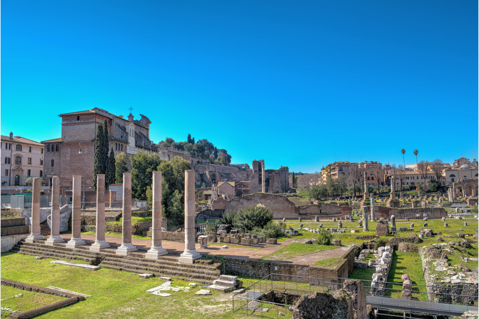
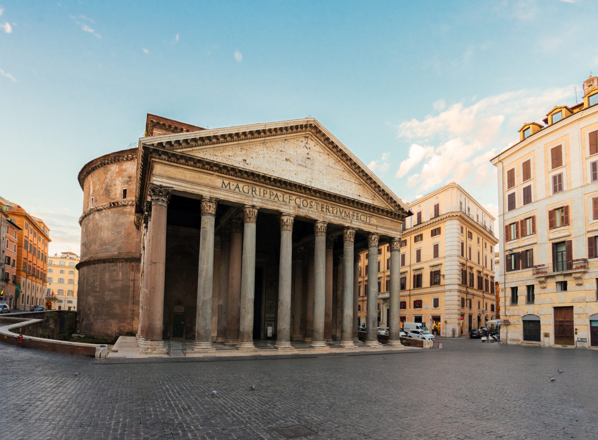
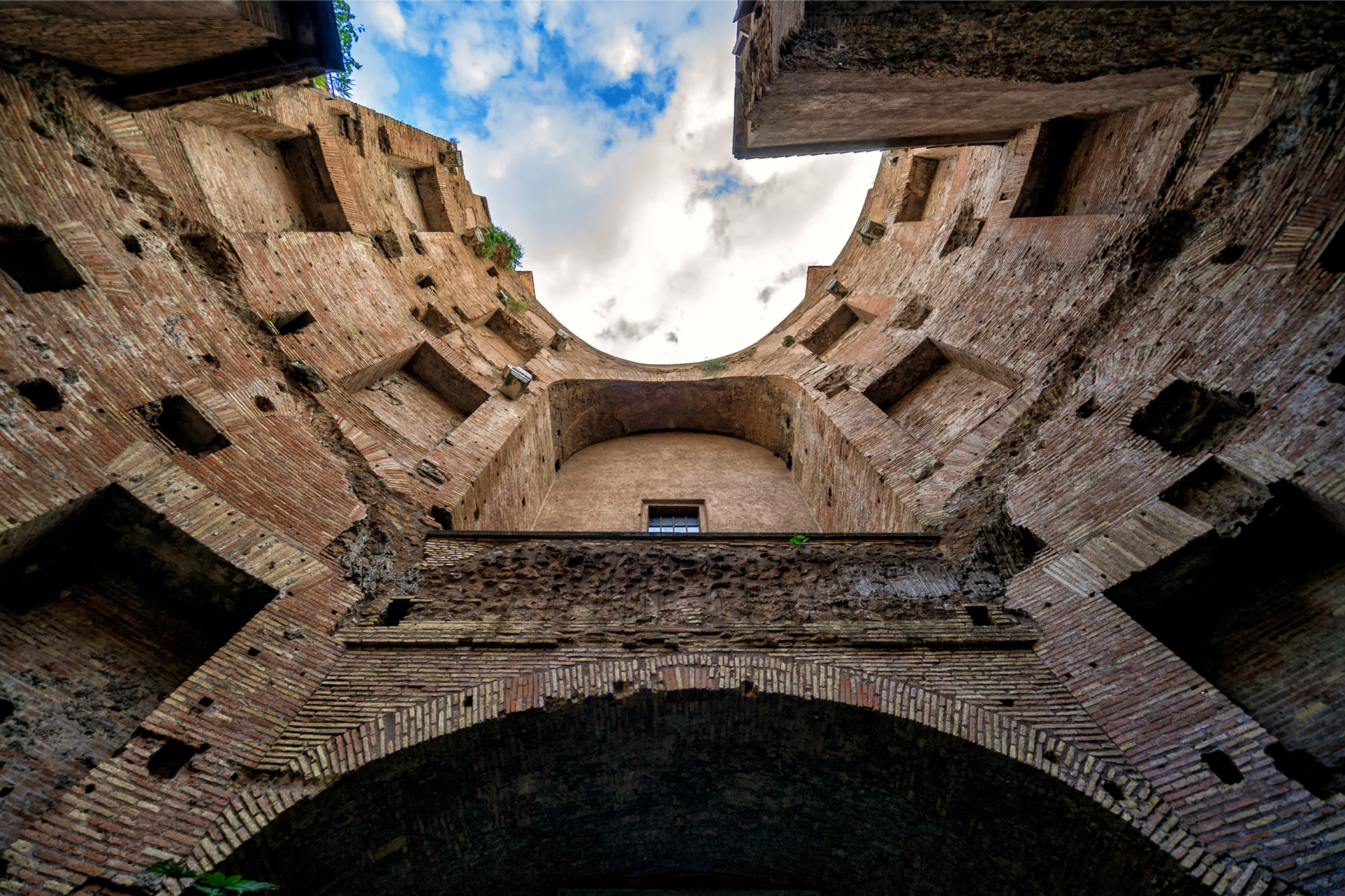
The most famous moment of Ancient Rome, it is still the symbol of the city and of Roman civilization in general. Initiated under the emperor Vespasian around 70-72 CE, it took ten years to complete and was opened in 80 CE by his son and successor, Titus. It was built on the false lake created for Nero’s enormous Domus Aurea. After Vespasian’s victory in the civil war following Nero’s assassination, the Domus Aurea was mostly torn down. The lake was filled in and the Colosseum was built on it.


Of note, the Romans did NOT refer to this building as “the Colosseum”. It was known as the Flavian Amphitheater, the name coming from the Flavian family of Vespasian himself. The more famous name comes from the enormous statue of Nero that stood almost as tall as the amphitheater itself which was moved there by Hadrian. His head was later lopped off and a more generic head of Hercules was put on top. It was a spectacular structure, named for a similar bronze statue on Rhodes, the Colossus, hence, the Colosseum.


The building, the largest of its kind the Romans ever built, held anywhere from 50,000 to 80,000 spectators at any time. It hosted gladiatorial contests and spectacles such as animal hunts, executions, mock sea battles (the bottom would be flooded), and more.


It continued to be used into the 6th century, though it eventually was converted into a cemetery. It was actually mostly intact until the mid-1300s when an earthquake caused the outer south side to collapse. The popes eventually began projects of restoration in the Renaissance and it is now one of the most popular tourist attractions in Rome.

Structures

A tour is fine, but I think it’s best to just wander the building. Here is a virtual tour that you can use before your visit

Logistics

For entry information, go here for an in-depth explanation.

Domus Aurea

Location

Just to the north of the Colosseum, it can be very difficult to find, so look at the Logistics section for more information.  

History

Infamously known by many names, most notably “Nero’s Pleasure Palace”, the Domus Aurea literally translates to “Golden House”.  It was built after the Great Fire of 64 CE destroyed a large part of the city. Instead of rebuilding people’s homes and businesses, Nero decided to build the ultimate palace to reflect his massive ego.


The villa’s opulence did not disappoint. It spread out over a third of the city during his reign, though some believe it was never fully completed. The dining chambers purportedly revolved (pulled by slaves) while waterfalls cascaded down the sides. A man-made lake stretched out towards the forum. For a detailed reconstruction, please go here.


Just a few decades after his death, the entire complex had been almost completely torn down and/or built on top of. Notably, the Baths of Trajan were built on top and the false lake created for the Domus was filled in to make the foundations for the Colosseum under the emperor Vespasian. Renaissance artists accidentally stumbled into the filled-up ceiling of the domus and began copying its artwork, influencing artists such as Raphael and Michelangelo.

Structures

This might be modern Rome’s greatest hidden treasure. It is not widely known, mostly because it is very dark inside, the entrance to the sight is guided and timed, and can be very hard to find.


The entirety of the site is underground, so you will have to wear a hard hat as it is still undergoing active excavation. The guide will show you the various halls, including the revolving dinner room (title photo above), as well as one of the rooms that Renaissance painters explored. VR goggles are given out to take a virtual tour of the Domus Aurea as it originally existed. The VR tour can be found here.


Honestly, nothing speaks more to the changing nature of Rome than this villa and its limited existence. Just like today, the city was never “completed” and buildings were often being torn down and/or built up based on the whims of the wealthy elite.


More information can be found here.

Logistics

You will need to buy your tickets in advance, so be sure to do it a few days in before you go. You may get your tickets here.


The other major piece is, of course, FINDING it. I wandered the area based on Google maps for a good 30 minutes before finding it closer to the bottom of the hill. (Again, if you’re using Google maps, ignore where it says the Domus Aurea is. The link up top links to an area closer to the entrance along the Oppian Hill at the Colle Oppia park, right across from the Colosseum.

Forum Boarium

Location
History

The name of the forum literally means cattle forum. It sat at the site of Rome’s original docks. The first gladiatorial contest took place here as well in 264 BCE.

Structures
The structures here are actually older than many of the ones in the Forum. The Temple of Hercules Victor dates from the 2nd century BCE. This is the circular peristyle building.
 
The traditional-looking building is the Temple of Portunus, dedicated to the god of rivers and ports, built between 100 and 80 BCE.
 
The unrestored Arch of Janus is in the very northeast of the forum and was built at a later date in the 4th century CE, using construction work from earlier buildings.
 
Logistics

All of the buildings are closed off, due to their age and state of relative preservation.

Imperial Fora

Location

Each of these fora is on the left or right of the Via dei Fori Imperiali that starts at the Colosseum. The link starts with the Forum of Augustus.

History

As Rome’s republican system transformed to autocracy, the new emperors would periodically use the space near the original Forum to build their own. The first was Julius Caesar (46 BCE)  followed by Augustus (2 BCE), then later Vespasian (75 CE), Nerva (97 CE), and finally Trajan (113 CE), whose forum was the most spectacular (and which includes his famous column detailing his victory over the Dacians). The Via dei Fori Imeperiali unfortunately cut through the heart of the Fora when Mussolini had it constructed, but a great deal is still visible.

Structures
Too many to name! This is another instance where I’ll let other websites do the talking:  
Logistics

Two of the fora, for Julius and Augustus Caesar, have night time shows that use projectors to show what they looked like back in the day. You are actually able to descend down in to Trajan’s Forum for the Julius Caesar tour and go under the road to tour the forum he had built. Both are worth the price of admission and more details can be found on their main website.

Insula dell'Ara Coeli

Location

At the foot of the Capitoline hill, off the Piazza d’Aracoeli.

History

A rare look at the type of  building that the vast majority of the population of ancient Rome lived in, this is the ruin of an insula, or an apartment block. The insula were several stories tall and, based on your income, the higher you lived, the poorer you were. (In the event of a fire, those at the top had the least likely chance of surviving.) About 380 people lived in an insula.

Structures

There were four floors to this particular insula. The ground floor was made up of shops, a mezzanine above, and the top two floors were residential.

Logistics

A visit to the insula is only available to organized groups. Click on this link for more information.

Theater of Marcellus

Location

On the Tiber, off the Via Luigi Petroselli.

History

The largest theater in ancient Rome, it was inaugurated under Augustus in 13 BCE in memory of his favored nephew, Marcellus, who had died in 23 BCE. It could hold up to 20,000 spectators in its day. More information on the site can be found here.


Included next to the theater are the remains of the temple of Apollo Sosianus, as well as the Porticus Octavia, named for Augustus’ sister (and Marcellus’ mother) Octavia, which was used as a fish market. The temple of Apollo was originally from the 5th century BCE but was radically restored by Gaius Sosius in 34 BCE.

Structures

The edifice of the structure survives, though about half of it is below ground level. The top includes the 16th century residence of the Orsini, which are now modern apartments. This site has a detailed description of the site and a reconstruction of what it used to look like.

Logistics

Using the link above, you are free to find it on a nice walk along the Tiber, near Tiber Island. Entry to the building’s lower levels is free, but do remember that the top is a private residence today.

Campus Martius

Castel Sant'Angelo & Pons Aelius

Location

Directly on the Tiber, due east of the Vatican. You can’t miss it.

History

Both the building and the bridge in front of it were commissioned by the emperor Hadrian in the year 134 CE to 139 CE. (The angels are later additions)


The building was Hadrian’s mausoleum, and it served as the burial place for all emperors after him, up to and including Caracalla. Most of their remains were lost in the Gothic invasions, though Hadrian’s urn survived and is now in St. Peter’s Basilica.

Structures

The top of the Castel Sant’Angelo is a later addition by the popes and reflects the building’s eventual transformation into a fortress during the Gothic Wars of the 6th century CE.


The bridge itself is almost completely intact, though the ramps that used to connect either side to the shore have been replaced two arches in the Roman style. It really is amazing that it has survived in such a a state of preservation.

Logistics

Again, just a stroll around town will bring you here. It’s free to the public to just gaze at it, though you cannot go inside.

Largo di Torre Argentina

Location

Due south of the Pantheon, on the Corso Vittorio Emanuele II. It’s a large square, so you can’t miss it.

History

One of those places that you would think the government would sign post a bit more, but this is actually the spot where Julius Caesar was assassinated.


The square hosts the ruins of four temples from the Republican era, as well as a piece of the theater of Pompey. The Senate house was being refurbished on the ides of March, 44 BCE, so they convened here at the theater instead, where they proceed to stab the dictator to death.


The name is also very confusing. Torre Argentina comes from Strasbourg, whose Latin name was Argentoratum. The Casa del Burcardo was constructed on this square by Johannes Burckardt, a native of Strasbourg nicknamed Argentinus. 

Structures

The temples’ functions aren’t entirely known, though many have guessed. They are named, from left to right, Temples A-D. I actually like Wikipedia’s breakdown so go there!

Meanwhile, Pompey’s theater is a bit hard to see. For more explanation, this website gives a detailed breakdown of where to find it. 

Logistics

Again, just a stroll around town will bring you here. It’s free to the public to just gaze at it, though you cannot go inside.

Mausoleum of Augustus & Ara Pacis

Location

Both buildings can be found on the Tiber, off the Lungotevere in Augusta.

History

I’m comboing these two, as they are both associated with the emperor Augustus.

The Ara Pacis (Altar of Augustan Peace) was commissioned by the Senate in honor of Augustus in 13 BCE. It details a vision of the civic religion of Rome, though it’s really a big propaganda piece, showing the imperial family and its various hangers-on.

The mausoleum was built in 28 BCE, well before Augustus died, and was intended to house his family’s remains. It ended up housing all of the Julio-Claudian emperors and their families, save Nero which means Caligula is buried here too.

Structures

The Ara Pacis itself is stunning. Khan Academy details it well. 


The mausoleum has just been restored, as of 2021. It no longer has overgrown vegetation, as in the picture above.

Logistics

Rome Museum gives another good overview of the structures and how to visit them.

Pantheon

Location

You’d have to try pretty hard to not find the Pantheon, but just in case, it can be found at the southern end of Piazza della Rotonda.

History

Originally built in the late 1st century BCE by Marcus Agrippa, the building you see today was actually built over 100 years later after a fire destroyed the original and lightning destroyed the emperor Domitian’s reconstruction.


The emperor Hadrian, deferring to Roman tradition, left Agrippa’s original inscription on the front. Translated the Latin inscription says “Marcus Agrippa, the son of Lucius, three times consul, built this.


The name pantheon refers to the pantheon of Roman gods, Jupiter, Mercury, Mars, Minerva, etc. who were worshipped within the temple. 


It survives to this day because it was converted into a church in the 7th century, thereby sparing it the decay that befell other parts of the city.

Structures

It really is hard to beat this, quite possibly the greatest building to survive from the height of Antiquity. The dome ensures it’s legendary status, still the world’s largest unreinforced concrete dome.


Again, a zillion other people have covered this building, so I’ll send you along your way with The Roman Guy’s detailed description.

Logistics

Rome Tool Kit gives all the basics you’ll need for a visit. It’s really a treat.

Temple of Hadrian

History

Commemorated by the emperor Antoninus Pius in the year 145CE in honor of his adoptive father Hadrian.

Structures

One wall and 11 columns remain, now part of Rome’s Chamber of Commerce. Both Atlas Obscura and Barcelo Experiences have detailed descriptions of the architecture of the temple.

Logistics

This is one to marvel at, but not much more. 😊

Trastevere

Ponte Rotto

Location

West of the Forum Boarium on the Tiber on the way to Trastevere.

History

Rome’s oldest stone bridge, it was known as the Pons Aemilius, constructed in 179 BCE. It lasted throughout the empire, but was severely damaged by floods in the Middle Ages. Half of it was still connected to the mainland until 1887, when most of it was torn down to make way for the Ponte Palatino. 

Structures

The single arch is all that remains of the bridge. The name Ponte Rotto simply means Broken Bridge.

Logistics

The best view is from the Ponte Palatino.

Northern Rome

Baths of Diocletian

Location

Just north of Termini station on Viale Enrico de Nicola.

History

The largest baths ever built in Rome, they were constructed at the end of the turbulent 3rd century CE by the emperor Diocletian, though it was finally completed in 306. It could accommodate over 3000 people at once.

Structures

Instead of listening to me, go to Inexhibit’s fantastic and exhaustive page about the baths, including reconstructions and models.

Logistics

Rome.net has all you need for tickets, times, and locations.

Southern Rome

Circus of Maxentius

Location
History

Built by the pretender emperor Maxentius during the period of civil war between himself and Constantine, historians are not actually sure that it was ever used.

Structures

This is one you’ll need to walk to on the Via Appia Antica in the park. It is completely free.

Logistics

Here is a handy site for the park. To get there, simply take the metro from Termini to the Giulio Agricola stop, then head west down the Viale Giulio Agricola (about a ten minute walk) and enter the park. Admission is free(!).

Park of the Aqueducts

Location

Part of the Appian Way Regional Park, on the way to the Alban Hills.

History

The centerpiece of the park, the Aqua Claudia, was begun by Caligula and completed by Claudius, undergoing extensive repairs in the following century. Its main springs, the Caeruleus and Curtius, were situated 300 paces to the left of the 38th milestone of the Via Sublacensis.


The total length was approximately 69 kilometers (43 mi), most of which was underground. The flow was about 190,000 cubic metres (6,700,000 cu ft) in 24 hours (about 2.3 cubic metres per second (80 cu ft/s)). Directly after its filtering tank, near the seventh mile of the Via Latina, it finally emerged onto arches, which increase in height as the ground falls toward the city, reaching over 30 meters (100 ft).

Structures

The Aqua Claudia is the main attraction and it is not to be missed. Along with it, there is also a more recent aquaduct, the Aqua Felice, started in the 16th century. A Roman villa, the Villa delle Vignacce, (constructed around the 2nd century CE), can also be found in the park.

Logistics

Here is a handy site for the park.

To get there, simply take the metro from Termini to the Giulio Agricola stop, then head west down the Viale Giulio Agricola (about a ten minute walk) and enter the park. Admission is free(!).